SAILBOAT ALONG THE INTRACOASTAL WATERWAY
- Paul Weston

- 2 days ago
- 7 min read

Our recent trip along the Atlantic Intracoastal Waterway, the ICW, from Fort Lauderdale in Florida to Norfolk Virginia in our 40’ sailboat was a wonderful experience, and I thought an account of our journey might be useful to other sailboaters making the trip for the first time.

The ICW is a system of connected rivers, canals, creeks and sounds that allows vessels of moderate draft and height to make their way along the eastern seaboard of the USA without venturing into the Atlantic.
Outline of Our Trip
Depart Fort Lauderdale 27th April 2026
Arrive Norfolk 3rd June 2026 (37 days)
Distance 1078 statute miles
Target for day’s run 50 statute miles
Longest day’s run 88 statute miles
Suggested Publications
Waterway Guide Southern Ship Store | Southern
Waterway Guide Mid-Atlantic Ship Store | Mid-Atlantic
Great Book of Anchorages The Great Book of Anchorages
We also had a very old book of charts. I suggest it is best to look at the selection of charts in a chandlery, and buy the one that suits you best. A small scale chart giving an overall view of the ICW would be very useful, but we were not able to find one.
Navigation
The ICW is generally well marked with beacon posts, and sometimes buoys. Red markers are left to port while traveling north. Occasionally, especially in estuaries, the buoyage system changes to IALA B (Red Right Return).
In the evenings, we thoroughly planned the route we would take the next day, based on the distance we intended to cover - usually about 50 miles. We entered waypoints along the route, useful when the ICW enters sounds as it is easy to become disoriented and turns are easy to miss. We looked for anchorages and marinas at around this distance, referring to the Waterway Guide books, and the Great Book of Anchorages. It was usually possible to enter as waypoints several potential anchorages. Marina stays were booked through Dockwa or by email.

We checked off bridges as we passed them in the log. In urban areas the bridges are close together, and it is easy to keep track, but in rural areas the bridges can be some distance apart. ICW distance markers appear on the Navionics charts every five miles, and it is worth entering these in the log as well.

Follow the magenta recommended route! Navionics charts have magenta lines which show recommended routes, and this generally gives the best chance of staying in deep water. In some areas, especially near sea inlets, channel marker buoys may be added where there is shoaling.
Along the ICW
Our boat, Kadash, aka Kim, is a 40’ aluminium sailboat with a ballasted vertically lifting keel.
Kim’s Details:
Length 40’ 12.2 m
Beam 14’ 4.3 m
Draft (keel down) 10’ 3.05 m
Draft (keel half down) 6’ 1” 1.85 m
Draft (keel up) 4’ 9” 1.45 m
Air draft (excluding antennas) 58’ 4” 17.8 m
3 cylinder Yanmar engine 40 bhp 30 kW
Cruising speed 5.2 statute miles/hour at 2000 rpm
Fuel consumption 10.1 US gallons/statute mile
Main navigation system Raymarine Axiom chartplotter with Navionics Eastern USA chart.
Fixed Bridges: Kim’s 58’ 8” air draft meant that she had no trouble with the fixed bridges. Nearly all of the bridges have height gauges, and we did not see any showing less than 63’. The navigable span of the bridge can generally be identified by the wooden fenders protecting the piers.

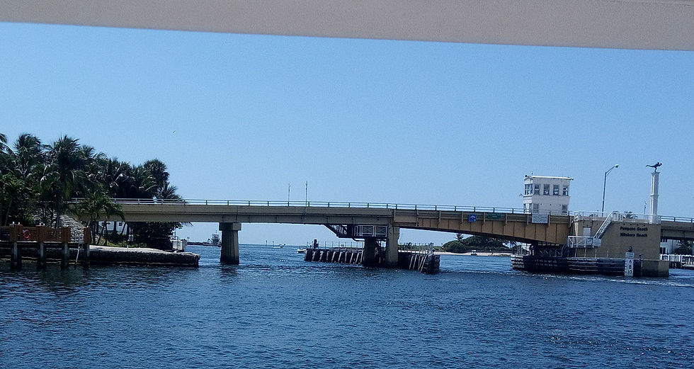
Opening Bridges: There are numerous opening bridges, especially in Florida. Bridge schedules are listed in the Waterway Guide books. At a few bridges, it may be necessary to wait for an hour or so during rush hours, but most open frequently or on request. When the bridge is in sight, call it on VHF (channels listed, usually 9 or 13) and request an opening. The bridge operator will tell you the time of the next opening, and you will have to wait at the side of the channel. Be careful if a strong current is carrying you down onto the bridge, keep your distance, and think about possible actions if you encountered a mechanical problem – this would probably involve anchoring quickly.
Cruising Speed: We cruised with the engine running at 2000 rpm, sufficient for 5.2 statute mph at 10.1 miles/US gallon.
Grounding: We traversed the ICW with Kim’s keel half down, giving 6’ 1” draft. We went aground several times, most often when cutting off corners. Two of these groundings were fairly violent, on quite hard sand. If we became stuck so that the engine would not pull us off, we raised the keel a few inches. On two occasions the bottom of the keel hit rocks, although we could see no damage to the boat when she was lifted out. We kept a Fortress aluminium anchor on the stern ready to use as a kedge, but had no occasion to use it. We joined Sea Tow, but did not make use of their services.

Fuel, Water, Pump Out: There are fairly frequent fuel docks along the route, but it is best to plan fuel stops in advance. Fuel docks always have water, and usually black water pump out facilities.

Provisioning and Shopping: There are few convenience stores near the ICW. We took Ubers to supermarkets. Some marinas have courtesy cars which can be borrowed for limited periods. Chandleries are generally a Uber ride away, as are hardware stores. Marinas accept Amazon deliveries for their customers.

Marinas and Moorings: Marinas are fairly frequent along the ICW, and those which cater to transients are listed in the Waterway Guides. They are invariably friendly and helpful. Transients are usually berthed at the end of the dock, but occasionally we were assigned a slip which can make berthing somewhat challenging if a tide is running. Moorings are often associated with marinas, and can be booked through Dockwa.

Tides and Currents: We looked up tide times on the internet, and tried to predict the likely currents. This was quite successful near and in the larger sounds, but not in the narrower parts of the ICW. Wind against tide in the larger inlets can create unpleasant conditions, and Kim did occasionally slam and take spray on deck.

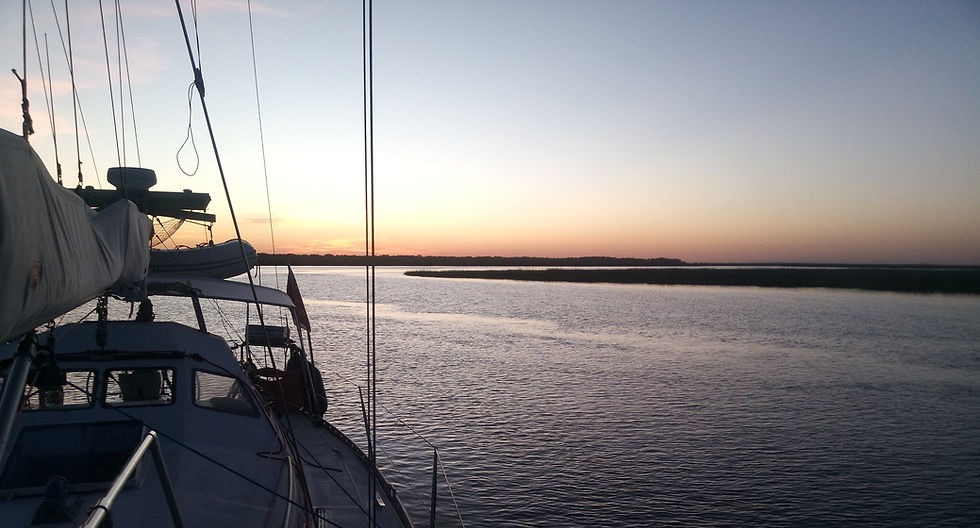
Anchoring: Anchoring is usually possible. In southern Florida anchorages can be quite restricted, but opportunities abound in most of the rest of the ICW. The Great Book of Anchorages is an excellent resource, although we came to realise that we could sometimes find anchorages nearby which were as good as the ones listed. The anchorages in the creeks of Georgia and the Carolinas are among the best experiences of the ICW, remote, secure, with abundant wildlife. The ground is usually mud, and we had no dragging incidents. We made sure the masthead light was switched on, and sometimes hung additional lights on the rails.
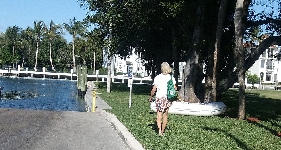
We made use of public boat ramps, taking advantage of the little wheels on the dinghy’s transom to pull it up the ramp to leave it on a convenient piece of grass.
Fatigue: Traversing the ICW in Kim was quite tiring - constant attention is required to stay in the channel, avoid other boats, and to negotiate bridges. The otherwise wonderful Yanmar is quite noisy, despite improvised additional insulation. When the wind was suitable, we set the jib, and this gave us extra speed. We wore earplugs and took turns below. We tried to get under weigh by six or six thirty, and generally stopped at about three in the afternoon. Planning so that we were familiar with the route was central to a smooth day’s run. Kim's cockpit is not very ergonomic for motoring, but we tried to adapt it as much as possible. Our aim, not always achieved in practice, was to do two full day (50 mile) runs, and then have a layover day.

Traffic and Overtaking: There was considerable traffic on some sections of the ICW. This was mostly composed of speedboats, which moved too quickly for Kim to take meaningful avoiding action. Larger overtaking vessels generally called on VHF 16 and told us they were about to overtake, slowing as they passed. We slowed Kim to make the manoeuvre as short as possible. There is occasional barge traffic, shrimpers with very long booms, and shipping in the larger inlets.


Laying Up: Our insurance policy does not cover the boat for hurricane damage south of 37o North, so Kim went north from Norfolk along the Chesapeake, and is now laid up ashore at Stingray Point Boat Works, 37o 33.7’ N, one of the many boat storage facilities in Deltaville VA.

Runs Ashore: We were pleasantly surprised by the range and variety of ‘runs-ashore’ along the ICW. In Florida, the Kennedy Space Centre at Cape Canaveral contrasted with the city of St Augustine, founded in 1565, and Savannah and Charleston are delightful cities with well preserved and presented antebellum architecture.

The United States may be a relatively young country, but they have packed in a lot of history. We visited interesting and well curated museums, including those run by local historical societies, which are well worth visiting.
The isolated inlets along the southeastern coast of the United States were a favourite haunt of pirates, and this history is brought to life by museums in St Augustine FL and Beaufort NC.

The trip along the ICW was a wonderful experience, easily achievable in a sailboat of moderate dimensions, and one I certainly recommend.


Comments